Kandergrund Is the Blausee, a Rock Face and the Railway Ramp
Kandergrund is a string of hamlets along the Kandertal road, anchored by the Blausee and overlooked by the Lötschberg railway ramp climbing to the tunnel.
- Flag
-

- ISO code
- CH
- Population
- 800
- Currency
- CHF
- Timezone
- Europe/Zurich
Kandergrund is the Blausee, a Rock Face and the Railway Ramp
Kandergrund is not a village you stroll through. It is a municipal area strung along the valley road, a collection of hamlets with no centre, no main square, no single point where you stop. The 805 residents who live here in 2023 spread across Ausserrüteni, Innerrüteni, Bunderbach, Mitholz, Kanderbrück and the Blausee-Mitholz station area. You drive through without realising you have entered it and without realising you have left it. What pulls travellers off the road is the Blausee. What keeps them looking up is the Lötschberg line climbing the valley wall above them.
The Blausee: a Manicured Forest Lake with an Entry Fee
What You Pay and What You Get
The Blausee is a private lake, owned by Blausee AG, and it charges entry. Adult tickets run in the region of CHF 12, children aged 6 to 15 pay roughly half that. These rates are set by the operator and revised annually. Check the Blausee website before you go. No booking is needed. Walk to the ticket booth, pay, and enter.
The site closes for the season in late autumn and reopens in spring. In summer the gates stay open until 21:00; winter hours are shorter, typically 09:00 to 17:00. Confirm the exact dates on the operator's site before you set out. Allow 45 to 90 minutes to walk the perimeter, watch the trout in the clear water, and decide whether you want to eat at the restaurant.
Not a Wild Lake
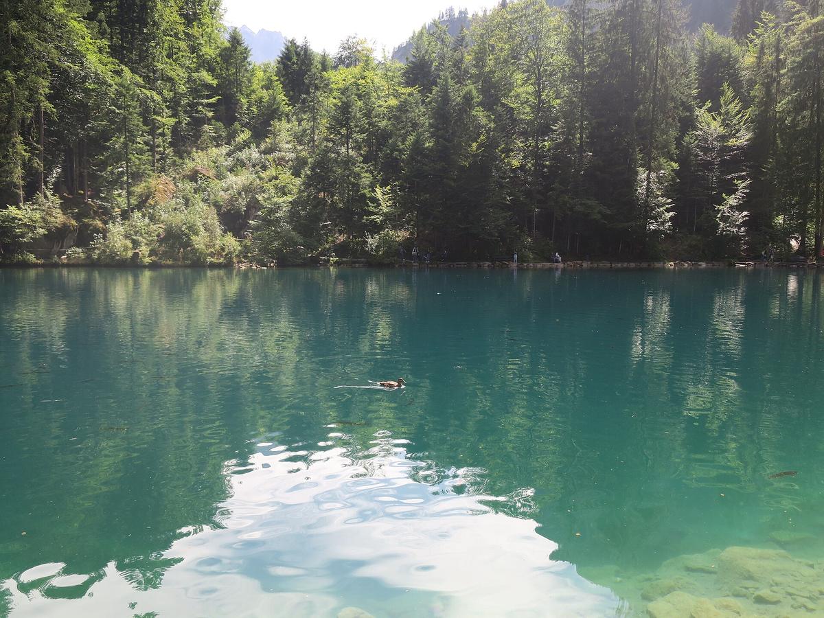
The Blausee is a 0.64-hectare pool fed by underground karst springs. Its water stays between 6 and 10 degrees Celsius all year. It is crystal clear. It is also manicured. The paths are gravel. The shoreline is trimmed. The picnic areas are set back in tidy rows. This is not a backcountry discovery. It is a landscaped park built around a natural phenomenon, and the trout farm operating in the same water is the reason the lake stays as clean as it does. If you want raw alpine wilderness, go to Gasterntal. If you want a short walk, a flat path, and a plate of fresh trout in a setting that looks like a postcard, the Blausee delivers exactly that.
How to Get There From the Train
The nearest station is Blausee-Mitholz on the BLS Lötschberg line. It is a request stop. Press the button on the platform or tell the train crew you intend to get off. The station sits at 974 metres elevation. From the platform, a signposted footpath leads 1.2 kilometres to the lake. That walk takes about 30 minutes. Alternatively, PostBus route 230 runs hourly between Frutigen and Kandersteg and stops at Blausee Be, a stop roughly 10 minutes from the lake entrance. Buy your ticket on the SBB Mobile app before boarding. Drivers do not sell tickets on board. Do not assume you can buy one when you step on.

The Lötschberg North Ramp: Why the Line Defines This Stretch of Valley
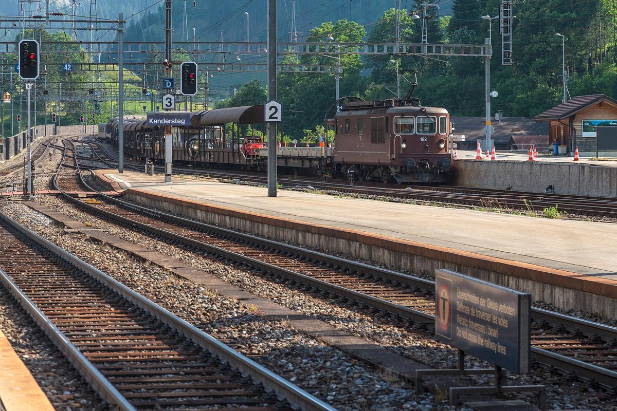
The Blausee is the reason most visitors stop. The railway is the reason the valley looks the way it does. The Lötschberg north ramp, operated by BLS Netz AG, runs approximately 14 kilometres from Frutigen to Kandersteg. It climbs the valley wall at a gradient of up to 27 parts per thousand, and it does so by looping back on itself inside the rock. Two spiral tunnels in the Kandergrund area, the Bunderbach loop tunnel and the Rotbach loop tunnel, allow the track to gain height in a short horizontal distance. The engineering was completed in 1913. It has not changed in its essentials since.
What You See From the Road
From the valley floor, you see the line crossing the rock face above the road. You see the avalanche gallery, a covered section that protects the tracks from slides, functional rather than scenic but part of the valley's working infrastructure. Trains move at a steady, effortful pace on the way to the tunnel portal at Kandersteg. The best vantage point for photographers is the hillside above the Bunderbach loop tunnel. From there you watch a train pass the same location at three different levels as it spirals upward. Bring a lens that handles low light. The valley sits in shadow for much of the day between October and December. The trains run on a regular hourly schedule, not a tourist timetable.
The ramp is not a tourist attraction. It is a working railway. But it is also the reason the valley has a station at Blausee-Mitholz at all, and the reason you can reach this stretch of the Kandertal from Bern in 55 minutes without a car. Take the train from Bern to Spiez. Change there for the RegioExpress on the Lötschberg line. Request the stop at Blausee-Mitholz. Hourly service. The same train continues toward Brig. You sit in a modern carriage and watch the ramp do its work from inside the spiral tunnels. That is the valley's character in a single ride: the infrastructure is functional, the terrain is serious, and the experience of passing through it is both quick and entirely unglamorous.
What Else Stands in Kandergrund: the Felsenburg Ruin and Two Walking Routes
The Felsenburg Ruin
The Felsenburg ruin is the only landmark in Kandergrund proper that predates the railway. First documented in 1339, it was burned by Upper Valais forces in 1400. The ruin sits at approximately 1,100 metres elevation, reachable only by a footpath from the valley floor. There is no road access. Walk from the hamlet of Mitholz. The climb takes about 40 minutes uphill. The reward is a set of remnant walls on a rock outcrop and a view down the valley toward Kandersteg. If you have already seen the Blausee and watched a few trains on the ramp, this is the one other thing to do before moving on.
Valley-Floor Walks
Two walking routes follow the valley floor. Kandergrund to Frutigen takes about one hour. Kandergrund to Reichenbach im Kandertal takes about 90 minutes. Both are flat, paved paths through a residential landscape. They are not alpine trails. Use them to connect between bus stops or to kill time before the next train. Kandergrund to Kandersteg takes roughly two and a half hours on the same valley-floor path. That is a full morning of walking along a road with traffic. Take the train instead. It covers the same distance in 10 minutes.

More destinations in Kandertal
What to See in Kandergrund
Frequently Asked Questions
Do I need to book tickets for the Blausee in advance?
No. Walk to the ticket booth and pay. The fee, set by Blausee AG, runs in the region of CHF 12 for adults and is revised annually. No booking system exists.
Can I see the Lötschberg ramp trains from the Blausee?
Not directly. The ramp is above the valley on the opposite side. You see it from the road between the station and the lake, not from inside the park.
Is Blausee-Mitholz station served by every train?
No. It is a request stop. Press the button on the platform or inform the crew before boarding. The hourly RegioExpress from Bern to Brig stops only on request.
How long should I spend in Kandergrund itself?
One to two hours covers the Blausee and a quick look at the ramp from the road. The Felsenburg ruin adds another hour if you hike up.
Read next
-
 Blausee
The Blausee in the Kandertal charges CHF 12 to enter a small forest lake. Here’s what that pays for, when it’s open, and how to reach it from Kandersteg.
Blausee
The Blausee in the Kandertal charges CHF 12 to enter a small forest lake. Here’s what that pays for, when it’s open, and how to reach it from Kandersteg.
-
 Kandertal Hotels and Mountain Inns Worth Booking
From the timber rooms of the Waldhaus in the Gasterntal to a dormitory bed at the Oeschinensee mountain hut, here are the Kandertal's real hotel options.
Kandertal Hotels and Mountain Inns Worth Booking
From the timber rooms of the Waldhaus in the Gasterntal to a dormitory bed at the Oeschinensee mountain hut, here are the Kandertal's real hotel options.
-
 Where to Stay in the Kandertal Valley for Hiking and Quiet
Compare the three places to sleep in the Kandertal—Kandersteg village, the Kiental farms, and the high hamlet of Griesalp—and find the right base for your hiking trip.
Where to Stay in the Kandertal Valley for Hiking and Quiet
Compare the three places to sleep in the Kandertal—Kandersteg village, the Kiental farms, and the high hamlet of Griesalp—and find the right base for your hiking trip.
-
 Things to Do in the Kandertal Summer Hiking and Winter Ski Touring
What there is to do in the Kandertal, split between summer hiking and winter ski touring, with the dead shoulder seasons clearly marked so you do not arrive to closed lifts.
Things to Do in the Kandertal Summer Hiking and Winter Ski Touring
What there is to do in the Kandertal, split between summer hiking and winter ski touring, with the dead shoulder seasons clearly marked so you do not arrive to closed lifts.
-
 Best Time to Visit the Kandertal and When to Stay Away
The Kandertal has two real seasons—high summer hiking and late-winter ski touring—and two long shoulder closures when the cable cars and huts simply shut.
Best Time to Visit the Kandertal and When to Stay Away
The Kandertal has two real seasons—high summer hiking and late-winter ski touring—and two long shoulder closures when the cable cars and huts simply shut.
-
 Getting Around the Kandertal Without a Car
The Kandertal runs on PostBuses with early last departures and no taxi backup. Learn the Gasterntal road rules, the SBB app, and why offline maps matter.
Getting Around the Kandertal Without a Car
The Kandertal runs on PostBuses with early last departures and no taxi backup. Learn the Gasterntal road rules, the SBB app, and why offline maps matter.
-
 Kandertal Itineraries for Two Days Four Days or a Week
Plan your Kandertal days around the reality that each side valley takes a full day and you cannot shortcut between them—here are itineraries for two, four and seven days.
Kandertal Itineraries for Two Days Four Days or a Week
Plan your Kandertal days around the reality that each side valley takes a full day and you cannot shortcut between them—here are itineraries for two, four and seven days.
-
 Kandersteg
 is the head of the Kandertal and the launch point for Oeschinensee, the Gemmi Pass and the Gasterntal. Here is what you reach from it.
Kandersteg
Kandersteg is the head of the Kandertal and the launch point for Oeschinensee, the Gemmi Pass and the Gasterntal. Here is what you reach from it.
-
 Reichenbach im Kandertal
 is the valley mouth where the road splits for Kandersteg or the Kiental. It is a junction, not a destination in itself.
Reichenbach im Kandertal
Reichenbach im Kandertal is the valley mouth where the road splits for Kandersteg or the Kiental. It is a junction, not a destination in itself.