What You Actually Get from the Kandertal
The Kandertal is a quiet glacial valley in the Bernese Oberland where the drama is in the rock walls and waterfalls, not in après-ski or shopping. Here is what you actually get.
- Flag
-
- ISO code
- CH
- Currency
- CHF
- Timezone
- Europe/Zurich
What You Actually Get from the Kandertal
Mid April to mid June and late October to mid December shut down most lifts and huts in the valley. If you arrive in those windows you will find locked cable car stations and snow covered high trails with no way up. Plan around that. The season is short and precise: July and August for hiking, late February to early March for ski touring. Outside those months the valley is quiet because it is half closed. That is not a bug. It is what the Kandertal is.
This is not one continuous resort. It is a string of dead end side valleys, each consuming a full day. You cannot shortcut between Oeschinensee, Gasterntal, Sunnbüel and Kiental without returning to the valley floor. The geography is linear: from Reichenbach at the valley mouth up to Kandersteg at the head, then branching laterally. Each branch is a separate commitment. The Kandertal rewards hikers and ski tourers who want silence rather than a scene. The drama is in the rock walls and waterfalls, not in après ski or shopping. The scale is intimate but the terrain is serious. Visitors consistently underestimate how long it takes to walk anywhere because the side valleys are steep and the bus schedules are sparse.
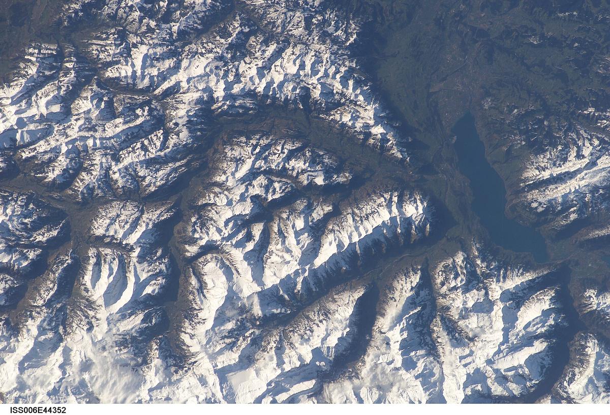

- Valley Axis: South to north, from Kandersteg (1,174 m) to Reichenbach im Kandertal (706 m), 14 km long.
- Best For: Hikers wanting high alpine trails without Jungfrau crowds, families with young children needing manageable lake walks, serious ski tourers, hut overnighters, travellers seeking silence.
- Not For: Nightlife seekers, luxury shoppers, anyone expecting a car free village centre with cobbled lanes, visitors who want a large interconnected ski circus.
- Minimum Days: Three full days. Weather closes in fast. You need a buffer to hit at least one high altitude objective like Oeschinensee or the Gemmi.
- Peak Season: July and August (all cable cars and huts open, high trails snow free); late February to early March (ski touring on spring snow).
- Avoid Window: Mid April to mid June (cable cars and huts closed, high trails snow covered); late October to mid December (nothing operates, valley sits in deep shade).
- Nearest Major Rail Junction: Spiez, under half an hour by train from Kandersteg.
- Arrival: Fly into Bern (BRN) or Zürich (ZRH). From Bern, train to Spiez, change for the Lötschberg line to Kandersteg station. From Zürich, train via Bern or Spiez. Full fare is in the CHF 35 to 80 band depending on route; check SBB.ch for the current price.
The Shape of the Valley: Linear, Not Circular
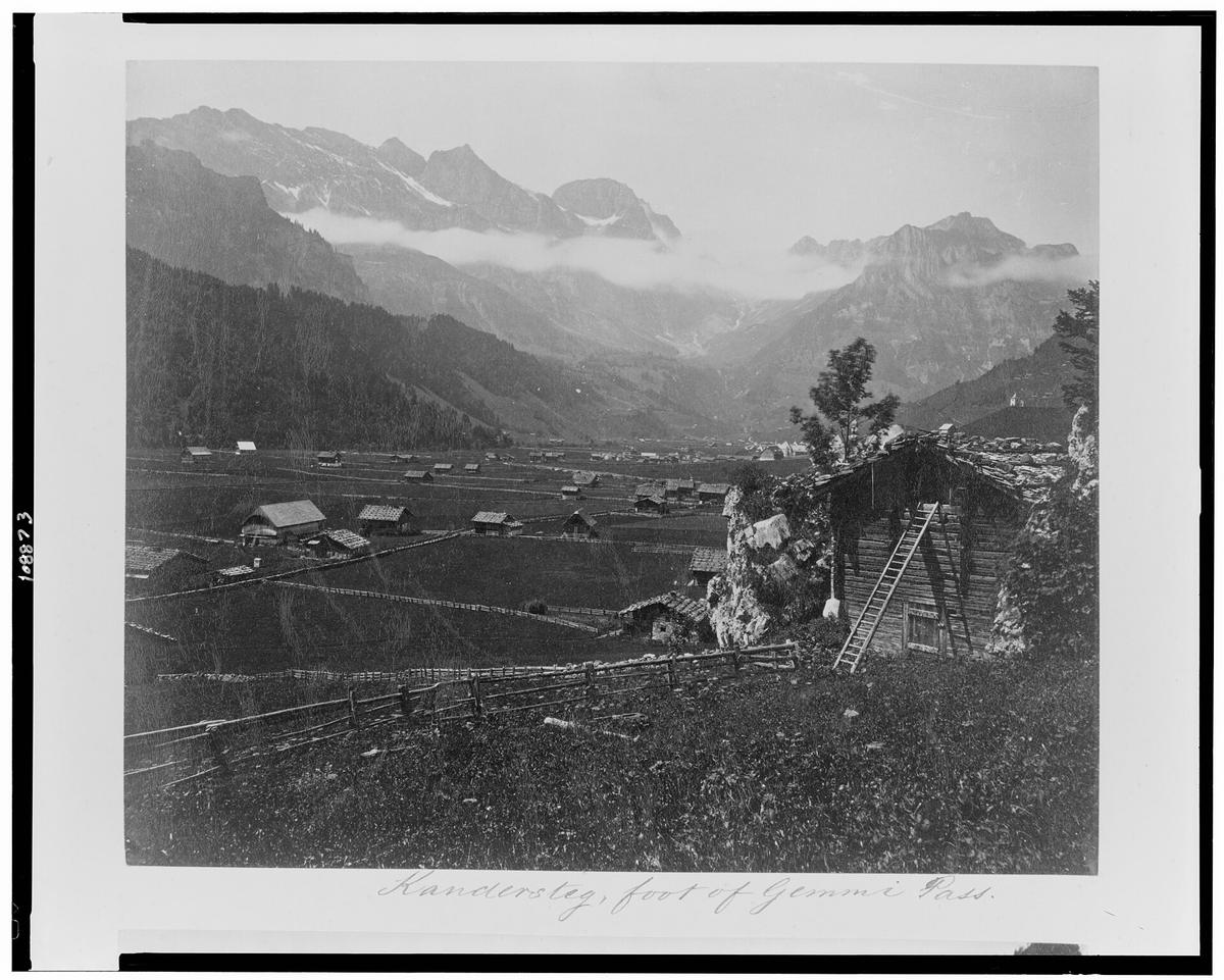
The Kandertal runs south to north, 14 km from Reichenbach im Kandertal at 706 m up to Kandersteg at 1,174 m. Reichenbach is a working village of 3,700 people, not a resort. Its station gets regional trains only. Kandergrund at 858 m is a dispersed hillside settlement with no real centre. Kandersteg at 1,174 m is the resort village with tourism infrastructure: a main street, two supermarkets, a railway station that catches InterCity trains. The single road from Spiez via Frutigen ends at Kandersteg. Beyond it there is no road. The Lötschen Pass at 2,690 m is foot traffic only.
Rail Access and the Car Shuttle
The BLS Lötschberg line gives you rail access. The old summit tunnel from 1913 serves Kandersteg directly. The newer base tunnel from 2007 bypasses it. The car carrying train from Kandersteg to Goppenstein runs every half hour in daytime and takes a quarter of an hour. BLS sets the fare in the CHF 27 to 31 band for a car with passengers; check the BLS website for the rate in force this season. Turn up and queue, no reservation needed. There is no equivalent in the UK.
Getting Around Once You Are Here
Getting around the valley requires the PostBus. Coins or the SBB Mobile app are your only options. Drivers do not sell tickets on board. The single biggest trip up is that the last bus from Griesalp or Gasterntal can leave as early as 16:30, even in summer, and there is no taxi backup. Miss it and you walk or hitch. Download offline maps and the SBB timetable before you leave Spiez. Swisscom has 4G in Kandersteg village and at Oeschinensee. Gasterntal and Griesalp have zero signal. Sunrise and Salt are patchy even in the valley.
The Side Valleys: Four Separate Full-Day Commitments
Each lateral valley is a dead end. You cannot link them without returning to Kandersteg. Budget one day per branch.
Oeschinensee
The turquoise lake under sheer cliffs is UNESCO listed. The cable car from Kandersteg runs May through October and December through March. The ride takes eight minutes. From the top station walk 25 minutes to the lake. The queue in July and August can exceed 90 minutes from 10:00. Arrive before 09:00 or after 14:00. Eat Älplermagronen with apple sauce at Berghaus Oeschinensee at 1,678 m. In winter the lake freezes. You ice fish and snowshoe. No skating, no organised rinks.
Gasterntal
A raw glacial valley with no phone signal and no village. The narrow toll road from Kandersteg is open May through October, snow dependent. Private cars need a day permit. The tourist office sets the rate, which sits in the CHF 15 band; ask at the counter in Kandersteg for the current figure. Cars are banned 10:00 to 16:00 in peak months. Walk across the wobbly wire suspension bridge over the glacial river. Overnight at the isolated Waldhaus hotel, open June through September. Buy dried Gasterntal air dried beef from the farm at Heimritz. Cash only. No card terminals above 1,500 m.
Sunnbüel and the Gemmi Pass
The cable car from Kandersteg to Sunnbüel at 1,934 m runs June through October and December through April. The ride takes eight minutes. From Sunnbüel walk 2 hours to the Gemmi Pass at 2,270 m. The view faces the Doldenhorn massif. Beyond the pass is Leukerbad in the Valais, foot only. Eat Rösti with melted Raclette du Valais at the Sunnbüel mountain station. The Sunnbüel Gemmi Leukerbad trail is a one way crossing. Returning the same day requires a taxi or bus from Leukerbad via a 2.5 hour loop. Not a quick shuttle.
Kiental and Griesalp
The Kiental branches west from Reichenbach and runs 12 km to Griesalp at 1,408 m. The PostBus from Reichenbach takes 45 minutes up the steepest postbus route in Europe, max gradient 28 per cent. Griesalp is an end of road hamlet and high altitude trailhead. The Kientaler via ferrata starts here, as do routes into the Blüemlisalp massif. Eat wild berry tart with cream at the Griesalp hotel, berries foraged on the alp. Cash is mandatory. No signal. The last bus down leaves early. Check the timetable before you go up.
Who This Valley is for and Who Should Skip it
The Kandertal is for hikers who want high alpine trails without the Jungfrau crowds. It is for families with young children who need manageable lake walks and cable cars. It is for serious ski tourers who want access to the Gemmi and the Blüemlisalp massif without lift queues. It is for people who specifically want to sleep in a mountain hut above the treeline. It is for travellers seeking silence rather than a scene.
Skip it if you want nightlife. Skip it if you want luxury shopping. Skip it if you want a car free village centre with cobbled lanes because Kandersteg has a main road running through it. Skip it if you expect a large interconnected ski circus with dozens of lifts. The valley is a collection of small separated pockets, not one continuous resort. The Oeschinensee cable car in summer is the only queue you will encounter. That queue can be long. But it is one queue, not a daily gauntlet.
A common mistake is assuming you can see Oeschinensee, Blausee, Gasterntal and the Gemmi in two days. You cannot. The valley is linear but the side branches are dead ends. Each one consumes a full day and you cannot shortcut between them without returning to the valley floor. Three days is the minimum. Four days covers the main sites. Seven days allows a multi day hiking programme with weather buffers.

Day Trips Worth Leaving the Valley for
The Kandertal is not a self contained universe. You should leave it for at least one day if you have four or more in the area.
- Thun: 40 minutes by train from Kandersteg. Lakefront old town, castle, weekend market. No car needed.
- Bern: 62 minutes direct. UNESCO old town, the bear pit, the Zytglogge. The train drops you at the edge of the old city.
- Leukerbad thermal baths: Walk the Gemmi in 4 hours then bus down, or drive 1 hour 15 minutes via the Lötschberg car shuttle. The baths are a Valais institution.
- Lötschental: 25 minutes by car shuttle train to Goppenstein, then bus into the valley. Deep traditional Valais with dark timber villages and a different dialect.
- Spiez castle: Under half an hour by train. Lakeside castle on Lake Thun with vineyards below. Walk from the station downhill.
None of these require a car. The rail connections from Kandersteg are good for a valley of this size. The BLS Lötschberg line gives you hourly service to Spiez, the regional junction. From Spiez you reach everything on Lake Thun and the Bernese Oberland.
The Practical Thing You Should Do Next
Before you book anything, check the operating calendar for the cable cars you need. The Oeschinen cable car runs May through October and December through March. The Sunnbüel cable car runs June through October and December through April. Those overlapping windows are your usable season. If you arrive in the shoulder season gap you will find locked stations and no way up. The BLS website and the Kandersteg tourism site publish the exact opening and closing dates for each year. Cross reference them with your travel dates. Then book accommodation that lets you cancel if the weather window closes.
That is the single most practical thing. Everything else follows.
Places in Kandertal
-
 Kandergrund
 is a string of hamlets along the Kandertal road, anchored by the Blausee and overlooked by the Lötschberg railway ramp climbing to the tunnel.
Kandergrund
Kandergrund is a string of hamlets along the Kandertal road, anchored by the Blausee and overlooked by the Lötschberg railway ramp climbing to the tunnel.
-
 Kandersteg
 is the head of the Kandertal and the launch point for Oeschinensee, the Gemmi Pass and the Gasterntal. Here is what you reach from it.
Kandersteg
Kandersteg is the head of the Kandertal and the launch point for Oeschinensee, the Gemmi Pass and the Gasterntal. Here is what you reach from it.
-
 Reichenbach im Kandertal
 is the valley mouth where the road splits for Kandersteg or the Kiental. It is a junction, not a destination in itself.
Reichenbach im Kandertal
Reichenbach im Kandertal is the valley mouth where the road splits for Kandersteg or the Kiental. It is a junction, not a destination in itself.
More on Kandertal
-
 Kandertal With Children What Actually Works and What Does Not
Blausee and Allmenalp work beautifully for families with young children in the Kandertal. Oeschinensee needs an early start, and Gasterntal and the Gemmi are better left for older legs.
Kandertal With Children What Actually Works and What Does Not
Blausee and Allmenalp work beautifully for families with young children in the Kandertal. Oeschinensee needs an early start, and Gasterntal and the Gemmi are better left for older legs.
-
 Kandertal Without a Car Does It Work and How Well
You can visit the Kandertal without a car, but sparse PostBus timetables, dead-end valleys and the last bus leaving at 16:30 demand more planning than in better-connected Swiss resorts.
Kandertal Without a Car Does It Work and How Well
You can visit the Kandertal without a car, but sparse PostBus timetables, dead-end valleys and the last bus leaving at 16:30 demand more planning than in better-connected Swiss resorts.
-
 Kandertal or Grindelwald Which Valley Suits Your Trip Better
Grindelwald delivers the Eiger, a lift network and international crowds. The Kandertal delivers silence, dead-end valleys and sparse buses. Here is which valley fits which traveller.
Kandertal or Grindelwald Which Valley Suits Your Trip Better
Grindelwald delivers the Eiger, a lift network and international crowds. The Kandertal delivers silence, dead-end valleys and sparse buses. Here is which valley fits which traveller.
-
 Kandertal in Winter What Is Open and What Shuts Completely
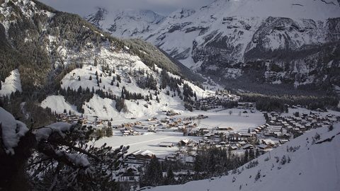
The Kandertal in winter is for ski tourers and cross-country skiers, not downhill resort skiers. Late October to mid-December is a dead window, and February to March is the real season.
Kandertal in Winter What Is Open and What Shuts Completely
The Kandertal in winter is for ski tourers and cross-country skiers, not downhill resort skiers. Late October to mid-December is a dead window, and February to March is the real season.
Common Questions
Is the Kandertal part of the Jungfrau region?
No. The Kandertal is the upper Kander valley in the Bernese Oberland. The Jungfraujoch has no direct access from here. You reach it via Grindelwald or Lauterbrunnen, both 55 km by road. The Kandertal is its own quiet pocket, not an extension of the Jungfrau circuit.
Can I drive into the Gasterntal?
Yes, but with restrictions. The single lane toll road requires a day permit. Cars are banned from 10:00 to 16:00 in peak months. Buy the permit at the Kandersteg tourist office; the rate is in the CHF 15 band. Or walk it in 90 minutes from the village and skip the car entirely.
Do I need cash?
Yes. Many alp huts and the Griesalp hotel do not take cards. There are no ATMs above 1,500 m. The village has two banks with cash machines. Withdraw enough before you go up. The PostBus also requires coins or the SBB Mobile app; drivers do not sell tickets.
When is the best time for ski touring?
Late February to early March for spring snow. The cable cars run December through March but the snowpack is more stable and the days longer in early spring. Avoid April: the lifts close mid April and the snow turns dangerously soft on the high passes.
Read next
-
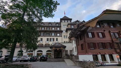 Kandertal Hotels and Mountain Inns Worth Booking
From the timber rooms of the Waldhaus in the Gasterntal to a dormitory bed at the Oeschinensee mountain hut, here are the Kandertal's real hotel options.
Kandertal Hotels and Mountain Inns Worth Booking
From the timber rooms of the Waldhaus in the Gasterntal to a dormitory bed at the Oeschinensee mountain hut, here are the Kandertal's real hotel options.
-
 Where to Stay in the Kandertal Valley for Hiking and Quiet
Compare the three places to sleep in the Kandertal—Kandersteg village, the Kiental farms, and the high hamlet of Griesalp—and find the right base for your hiking trip.
Where to Stay in the Kandertal Valley for Hiking and Quiet
Compare the three places to sleep in the Kandertal—Kandersteg village, the Kiental farms, and the high hamlet of Griesalp—and find the right base for your hiking trip.
-
 Things to Do in the Kandertal Summer Hiking and Winter Ski Touring
What there is to do in the Kandertal, split between summer hiking and winter ski touring, with the dead shoulder seasons clearly marked so you do not arrive to closed lifts.
Things to Do in the Kandertal Summer Hiking and Winter Ski Touring
What there is to do in the Kandertal, split between summer hiking and winter ski touring, with the dead shoulder seasons clearly marked so you do not arrive to closed lifts.
-
 Best Time to Visit the Kandertal and When to Stay Away
The Kandertal has two real seasons—high summer hiking and late-winter ski touring—and two long shoulder closures when the cable cars and huts simply shut.
Best Time to Visit the Kandertal and When to Stay Away
The Kandertal has two real seasons—high summer hiking and late-winter ski touring—and two long shoulder closures when the cable cars and huts simply shut.
-
 Getting Around the Kandertal Without a Car
The Kandertal runs on PostBuses with early last departures and no taxi backup. Learn the Gasterntal road rules, the SBB app, and why offline maps matter.
Getting Around the Kandertal Without a Car
The Kandertal runs on PostBuses with early last departures and no taxi backup. Learn the Gasterntal road rules, the SBB app, and why offline maps matter.
-
 Kandertal Itineraries for Two Days Four Days or a Week
Plan your Kandertal days around the reality that each side valley takes a full day and you cannot shortcut between them—here are itineraries for two, four and seven days.
Kandertal Itineraries for Two Days Four Days or a Week
Plan your Kandertal days around the reality that each side valley takes a full day and you cannot shortcut between them—here are itineraries for two, four and seven days.
-
Kandersteg
Kandersteg is the head of the Kandertal and the launch point for Oeschinensee, the Gemmi Pass and the Gasterntal. Here is what you reach from it.
-
Reichenbach im Kandertal
Reichenbach im Kandertal is the valley mouth where the road splits for Kandersteg or the Kiental. It is a junction, not a destination in itself.
-
Kandergrund
Kandergrund is a string of hamlets along the Kandertal road, anchored by the Blausee and overlooked by the Lötschberg railway ramp climbing to the tunnel.